Here you’ll get the latest update on the weather forecast for this year’s Round the Island Race.
The forecast can often be very changeable in the build-up to the race, so we encourage you to check this page on a daily basis as we approach the race weekend.
Our apologies, we are having some issues trying to upload the video of the race briefing. In the meantime, you can view the presentation document by clicking below.
UPDATED STATEMENT – Friday 6th June
At this time, we don’t expect to cancel any classes.
The expectation is that, given the increase in wind speeds is likely to be gradual, the fleet should be clear of the Needles and a significant way down the back of the Island before these winds arrive.
Once past St Catherine’s, there should be significant shelter across the Bay, and once yachts pass Bembridge, there will be significant shelter from the Island.
It has been declared that life jackets shall be worn by all competitors throughout the race. Inspections will take place at both the start and finish to ensure compliance.
Based on current forecasts, our traffic light system is green, meaning everything is looking good, currently.
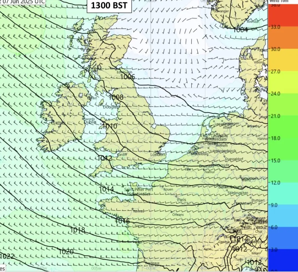
The low to the North trails a front across South England, with a moderate, occasionally strong WSW veering W & squally showers on and off throughout.
Wind: SW 13-18, gusting 22 kts with squally showers, veering WSW/W, 13-18 gusting 20 kts.
Temperature: 15-17⁰C on land, 14-16⁰C at sea.
Sea conditions: 0.5-0.8m in the East Solent, 1.8-2.2m in the West Solent, 2-2.5m outside, 5-7s period.
The low coming in from the west should be over the Midlands by noon.
This should bring a moderate, becoming quite strong and blustery SW/WSW with squally showers, likely on and off through the morning and early afternoon.
Wind: SW 13-18, gusting 22 kts, increasing SW 20-25 gusting 30 kts with squally showers, veering WSW 20-25 gusting 30 kts through the afternoon, then easing W/WSW 13-18 gusting 20 kts by early evening.
Temperature: 15-17⁰C on land, 14-16⁰C at sea, sea surface 14-15⁰C.
Sea conditions: 0.5-0.8m in the E Solent, 1.8-2.2m in the W Solent, 2-2.5m outside, 5-7s period.
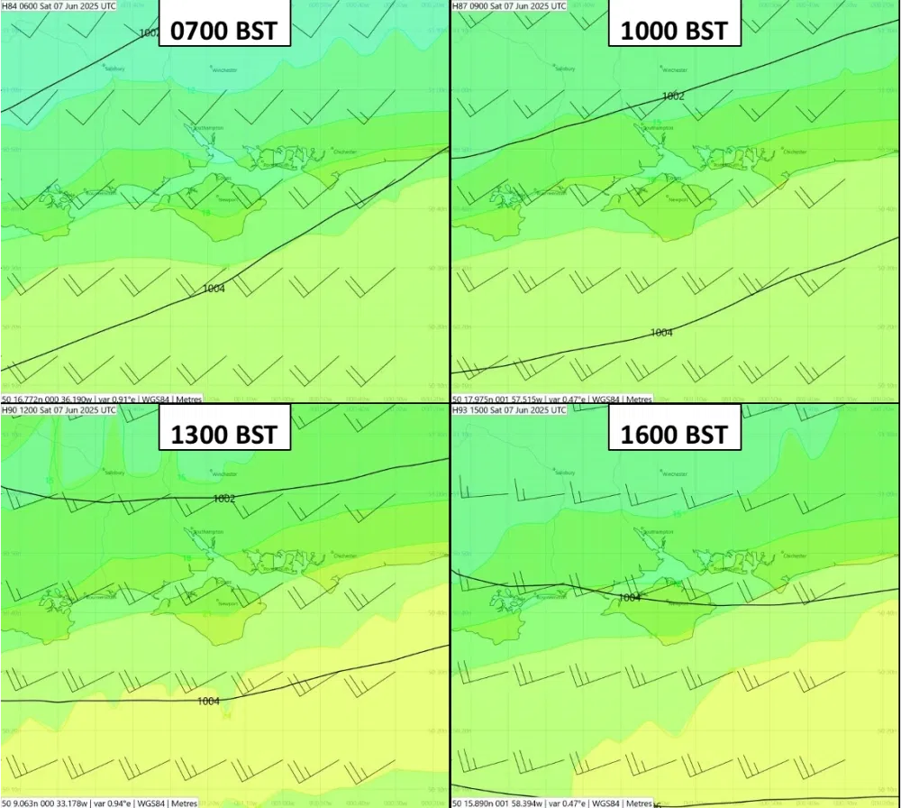
The low coming in from the W should pass over the UK during the day, centred over Ireland at dawn, N Wales by noon and moving into the North Sea by dusk.
The morning and early afternoon are likely to be squally with occasionally heavy rain, drying up by mid afternoon.
Wind: SW 12-15 gusting 18 kts at the start, increasing SW 20-25 gusting 30 kts with squally showers by noon, increasing further SW 22-27 gusting 32 kts by early to mid afternoon, veering W/WSW 20-25 gusting 30-32 kts by early evening.
Temperature: 15-17⁰C on land, 14-16⁰C at sea, sea surface 14-15⁰C.
Sea conditions: Building to 0.6-1m in the E Solent, 1.8-2.2m in the W Solent, 2.5-3m outside.
The low coming in from the W should pass over the UK, centred over Ireland at dawn, N Wales by noon, with a front over the Island, then moving into the North Sea by dusk.
The morning through to early afternoon will be squally with occasionally heavy rain, drying up by mid-afternoon with only
scattered showers.
Wind:
• SW/WSW 12 -15 gusting 18 kts at the start.
• Increasing SW 20 – 25 gusting 30 kts with squally showers by noon.
• SW 24 – 28 gusting 35 kts by early to mid afternoon.
• Peaking by 1600 at SW 26-31 gusting 35 – 40 kts around the back of the Island.
• Veering W/WNW 22 – 27 gusting 30-32 kts by early evening.
Temperature: 15 – 17⁰C on land, 14 – 16⁰C at sea, sea surface 14-15⁰C.
Sea conditions: Building to 0.8 – 3m in the E Solent, 1.8 – 2.2m in the W Solent, 2.5 – 3m outside, 5-7s